By Mark Dovich
A recently-published report by the International Crisis Group (ICG), a Brussels-based think tank, highlights three potential areas for cooperation between Armenia and Azerbaijan in the northern region along their shared border. The report comes after clashes erupted in the area in mid-July in the deadliest outbreak of hostilities between the two countries since 2016, refocusing international attention on the Nagorno-Karabakh conflict and how it has morphed into a direct conflict between two states – Armenia and Azerbaijan.
The ICG report suggests that the Armenian and Azerbaijani governments have common interests in three key areas that affect daily life for residents of the border region: guaranteeing farmers’ security, repairing water supply networks, and clearing landmines. All three cases envisage first steps toward limited cooperation that could serve as trust-building measures to prepare for more robust and comprehensive talks in the future.
Though the area has rich agricultural lands, farmers are often hesitant to grow crops or herd livestock for fear of being injured or killed, either by sniper fire or by landmines. Nonetheless, many farmers have no choice but to risk undertaking agricultural activities, as the region’s non-agricultural economic sector is severely underdeveloped, and subsistence farming remains widespread. Indeed, the border region actually supplies both countries with significant amounts of agricultural products, particularly on the Azerbaijani side. Consequently, the ICG report encourages the Armenian and Azerbaijani authorities to take steps to improve cross-border communication and “inform each other of any plans for works on land” near the border.
The region’s water supply networks present another crucial challenge to residents–and possibility for bilateral cooperation. The area’s water supply comes primarily from a network of reservoirs of irrigation pipes located directly on the border. Since the outbreak of conflict in Nagorno-Karabakh in the early 1990s, the system’s location on the border made it impossible to maintain, and it subsequently fell into disuse. For instance, the Joghaz reservoir, one of the largest in the area, supplied water to nearly 30 villages on both sides in Soviet times, but now supplies just a few households. With neither side having the expertise or capacity to solve the region’s chronic water shortages, the ICG report suggests that “circumscribed technical talks” with the involvement of “an independent international actor…could help facilitate limited discussions…about the repair of specific water infrastructure for mutual benefit.”
Likewise, the report proposes that the Armenian and Azerbaijani authorities take steps to address demining in the area with an eye toward “clearly demarcating where landmines may be buried near farmlands and water sources to prevent accidents.” The region remains heavily mined, though no reliable data exists on the number of unexploded ordnance along the border. Though some demining work has been conducted on the Azerbaijani side, both Armenia and Azerbaijan say they have refrained from more widescale demining efforts because they cannot guarantee the safety of their deminers. Nonetheless, the ICG report recommends the two sides undertake communication and mapping efforts as first steps in the complicated and dangerous process of demining the border.
Daily Life Along the Armenian-Azerbaijan Border
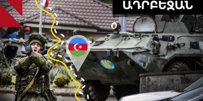
The area, covered on the Armenian side by Tavush province and on the Azerbaijani side by the districts of Aghstafa, Gadabay, Gazakh, and Tovuz, is highly densely populated. There are over 100 villages and towns located within 10 kilometers of the border on both sides, home to more than 38,000 Armenian citizens and more than 110,000 Azerbaijani citizens.
Day-to-day life in the area “is constrained by fear of renewed clashes,” limiting economic development. Indeed, “the anxiety” resulting from “the prospect of civilian casualties” is an “omnipresent feature of life in the area,” according to the ICG report.
Assistance to households in the area by both the Armenian and Azerbaijani governments remains limited, though some effort has been made. In Azerbaijan, small-scale infrastructural and irrigation projects have been carried out, while in Armenia, funds raised by diaspora groups have been put toward the construction of medical facilities and schools. Both governments have also introduced subsidy programs for residents of the area.
Nonetheless, these limited assistance programs have done little to hinder massive population outflows from the region: in recent years, many residents, overwhelmingly young men, have moved to find work in Baku, Yerevan, or third countries, primarily Russia and Turkey, sending remittances back to their relatives who remain in the area. According to the ICG report, this “reliance on remittances from male family members has led” to an uptick in sex-selective abortions on both sides of the border.
Life for the area’s residents is further complicated by military and strategic considerations. According to the ICG report, “neither side has a clear military advantage in the border zone, leading to an unstable standoff characterized by frequent ceasefire violations”–in stark contrast to the situation in Nagorno-Karabakh, where ethnic Armenian forces have a clear and significant strategic advantage.
Moreover, the area is home to a number of key roads, railways, and pieces of energy infrastructure. Major roads and railways connecting Armenia and Azerbaijan with Georgia–through which people and goods can transit to Russia and Turkey–run near the border. Additionally, four major oil and natural gas pipelines, one on the Armenian side and three on the Azerbaijani side, are located nearby.
Complicating matters further, the border itself officially remains undemarcated, and instead corresponds to the Soviet-era administrative boundary between the Armenian and Azerbaijani Soviet Socialist Republics.
Finally, the region’s farmers are expected to be severely impacted by the looming climate crisis, which experts forecast will result in decreased rainfall and increased temperatures in the area. Agricultural production on both sides of the border depends considerably on Armenian and Azerbaijani river flows, which the U.S. Agency for International Development projects will decrease by nearly 12 percent by 2030.
In photo: Joghas reservoir on the Armenian-Azerbaijani border.
Photo credit: Vardan Petrosyan